
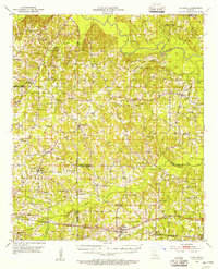
1952 Map of Calhoun
USGS Topo · Published 1953About this map
Downsville and the agricultural lands of the northern Louisiana parishes appear here in the early 1950s, a landscape defined by small rural communities and numerous country churches. The map captures the area just before significant modernization, showing a network of unimproved roads connecting family-named landmarks and local institutions like the Shady Grove Ch & Cem and Lane Sch. The southern portion is anchored by Calhoun and the Experiment Station, situated along the Illinois Central rail line.
Find a feature on this map
74 named features on this map. Tap any name to fly to it.
Don’t see what you’re looking for? This feature index may not catch every label — zoom into the map to look around manually.
Map Details
Editions of this 1952 Calhoun Map
3 editions found
Other maps of this area

1935 · Drew
USGS Topo · 1:62,500

1935 · Haile
USGS Topo · 1:62,500

1940 · Monroe
USGS Topo · 1:62,500

1950 · Ruston
USGS Topo · 1:62,500

1951 · Ruston
USGS Topo · 1:62,500

1951 · Bernice
USGS Topo · 1:62,500

1952 · Farmerville
USGS Topo · 1:62,500

1953 · Chatham
USGS Topo · 1:62,500

1953 · Hodge
USGS Topo · 1:62,500

1955 · Shreveport
USGS Topo · 1:250,000