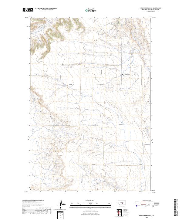
2024 Map of Hailstone Basin SE
USGS Topo · Published 2024About this map
Assumption Catholic Cem stands as a quiet focal point in this portion of the Montana prairie, situated along Stiles Rd near the junction with Church Rd. The landscape is defined by the subtle drainage basins of several meandering watercourses, including Painted Robe Creek in the northwest and Gooseneck Creek to the northeast. The region's rural character is established by a sparse network of section-line roads, such as Hoagland Rd and Arnold Rd, which provide access across the township boundaries of t4n r21e and t4n r22e. This 2024 survey illustrates a modern snapshot of the Stillwater County hinterland, where the terrain transitions toward Lost Creek and Comanche Creek. The map provides a precise layout of land divisions and local connectors like Mosdal Rd and Hucke Rd, reflecting the enduring agricultural and ranching patterns of the Northern Plains.
Find a feature on this map
21 named features on this map. Tap any name to fly to it.
Don’t see what you’re looking for? This feature index may not catch every label — zoom into the map to look around manually.
Map Details
Editions of this 2024 Hailstone Basin SE Map
This is the sole edition of this map. No revisions or reprints were ever made.
Other maps of this area

1889 · Big Snowy Mountain
USGS Topo · 1:250,000

1892 · Stillwater
USGS Topo · 1:125,000

1893 · Big Snowy Mountain
USGS Topo · 1:250,000

1954 · Billings
USGS Topo · 1:250,000

1954 · Roundup
USGS Topo · 1:250,000

1956 · Battle Butte
USGS Topo · 1:24,000

1956 · Wheat Basin
USGS Topo · 1:24,000

1956 · Rock Spring
USGS Topo · 1:24,000

1957 · Billings
USGS Topo · 1:250,000

1958 · Billings
USGS Topo · 1:250,000