
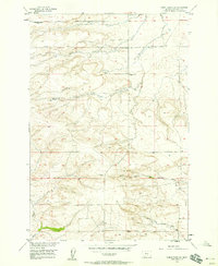
1956 Map of Wheat Basin
USGS Topo · Published 1957About this map
Wheat Basin serves as a central point of interest in this mid-century topographic study of Stillwater County. The landscape is characterized by its large, shallow basins and seasonal water bodies, most notably the Halfbreed Lake National Wildlife Refuge and the expansive Big Lake to the south. The Northern Pacific railroad cuts a diagonal line through the heart of the Basin, illustrating the critical role of rail transport in moving grain and cattle from this prairie environment. Scattered oil wells and other mineral explorations hint at the industrial layers beneath the agricultural surface. The map also captures the intricate drainage patterns of Cedar Creek and Lost Creek, which navigate the subtle elevation changes of Rattlesnake Ridge and the surrounding terrain. This survey provides a precise look at the 1950s rural infrastructure, from the Refuge Boundary to the isolated homesteads and wells that defined life in this corner of Montana.
Find a feature on this map
13 named features on this map. Tap any name to fly to it.
Don’t see what you’re looking for? This feature index may not catch every label — zoom into the map to look around manually.
Map Details
Editions of this 1956 Wheat Basin Map
This is the sole edition of this map. No revisions or reprints were ever made.
Other maps of this area

1889 · Big Snowy Mountain
USGS Topo · 1:250,000

1892 · Stillwater
USGS Topo · 1:125,000

1893 · Big Snowy Mountain
USGS Topo · 1:250,000

1954 · Billings
USGS Topo · 1:250,000

1954 · Roundup
USGS Topo · 1:250,000

1956 · Hunter Lake
USGS Topo · 1:24,000

1956 · Battle Butte
USGS Topo · 1:24,000

1956 · Molt
USGS Topo · 1:24,000

1956 · Rock Spring
USGS Topo · 1:24,000
1956 · Wheat Basin SW
USGS Topo · 1:24,000