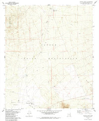
1979 Map of Haivana Nakya
USGS Topo · Published 1985About this map
Haivana Nakya and San Vicente sit within the vast expanse of the Papago Indian Reservation during the late 1970s. This survey records a desert landscape defined by ephemeral watercourses like Anegan Wash, Pavo Kug Wash, and San Vicente Wash, which drain the surrounding highlands. The topography transitions from the North Comobabi Mountains in the northwest to the Quinlan Mountains in the south, separated by the wide Baboquivari Valley. Evidence of rural settlement and land use is sparse but significant, including the Santa Rosa Ranch, the community of Schuchk, and several isolated Well sites and corrals. A network of unimproved roads and a Jeep Trail provide the only access through this arid terrain, highlighting the isolated nature of these ranching and tribal outposts before further modernization of the region.
Find a feature on this map
18 named features on this map. Tap any name to fly to it.
Don’t see what you’re looking for? This feature index may not catch every label — zoom into the map to look around manually.
Map Details
Editions of this 1979 Haivana Nakya Map
2 editions found
Other maps of this area

1934 · Silver Bell
USGS Topo · 1:125,000

1937 · Comobabi
USGS Topo · 1:48,000

1938 · San Vicente
USGS Topo · 1:62,500

1941 · San Vicente
USGS Topo · 1:62,500

1941 · Baboquivari Peak
USGS Topo · 1:62,500

1941 · Sells
USGS Topo · 1:62,500

1942 · San Vicente
USGS Topo · 1:62,500

1942 · Comobabi
USGS Topo · 1:62,500

1943 · Sells
USGS Topo · 1:62,500

1943 · Fresnal
USGS Topo · 1:125,000
Featured Places
- Schuk Toak District, AZ
- Haivana Nakya, Schuk Toak District
- Schuchk, Schuk Toak District
- San Vicente, Schuk Toak District
- Pima County, AZ