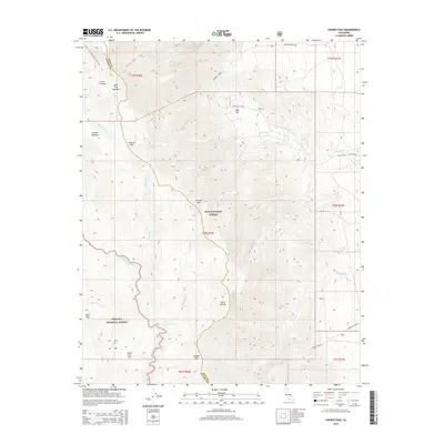
2015 Map of Haiwee Pass
USGS Topo · Published 2015About this map
Haiwee Pass and Olancha Pass anchor this high-elevation segment of the Sierra Nevada along the boundary of Inyo National Forest and Sequoia National Forest. The landscape is defined by its drainage systems, where the S Fork Kern River flows through the southwestern portion of the sheet, while numerous creeks like Honeybee Cr, Walker Creek, and Hogback Cr descend the eastern slopes toward the basin. Pockets of level terrain appear at Sage Flat and Dutch John Flat, providing rare breaks in the steep topography. Long-distance trekking is represented by the Pacific Crest National Scenic Trail, which skirts the northwestern peaks near Bear Trap Meadow and Summit Meadow. This survey documents a wilderness area where accessibility is primarily limited to rugged routes like Haiwee Canyon Rd and Sage Flat Road.
Find a feature on this map
35 named features on this map. Tap any name to fly to it.
Don’t see what you’re looking for? This feature index may not catch every label — zoom into the map to look around manually.
Map Details
Editions of this 2015 Haiwee Pass Map
This is the sole edition of this map. No revisions or reprints were ever made.
Other maps of this area

1905 · Olancha
USGS Topo · 1:125,000

1907 · Olancha
USGS Topo · 1:125,000

1908 · Ballarat
USGS Topo · 1:250,000

1913 · Ballarat
USGS Topo · 1:250,000

1948 · Death Valley
USGS Topo · 1:250,000

1948 · Fresno
USGS Topo · 1:250,000

1951 · Keeler
USGS Topo · 1:62,500

1951 · Haiwee Reservoir
USGS Topo · 1:62,500

1954 · Death Valley
USGS Topo · 1:250,000

1955 · Fresno
USGS Topo · 1:250,000