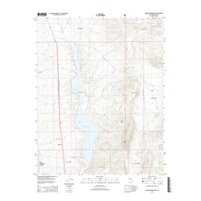
2015 Map of Haiwee Reservoirs
USGS Topo · Published 2015About this map
The Los Angeles Aqueduct and Second Los Angeles Aqueduct define the industrial and hydrological character of this Inyo County landscape, channeling water south through the North Haiwee Reservoir and South Haiwee Reservoir. Situated at the edge of the Mojave Desert, the small settlement of Haiwee sits at the base of the Sierra Nevada foothills, where the mountains meet the arid basin floor. The geography transition is marked by the presence of the Inyo National Forest to the west and the expansive Cactus Flat and Haiwee Ridge to the east. Local drainage patterns, such as Hogback Cr and Summit Cr, feed into the engineered valley system that has served as a critical piece of California's water infrastructure for a century. Secondary roads like Cactus Flats Rd and Enchanted Lake Rd provide access through the rugged terrain of the eastern slopes.
Find a feature on this map
26 named features on this map. Tap any name to fly to it.
Don’t see what you’re looking for? This feature index may not catch every label — zoom into the map to look around manually.
Map Details
Editions of this 2015 Haiwee Reservoirs Map
This is the sole edition of this map. No revisions or reprints were ever made.
Other maps of this area

1905 · Olancha
USGS Topo · 1:125,000

1907 · Olancha
USGS Topo · 1:125,000

1908 · Ballarat
USGS Topo · 1:250,000

1913 · Ballarat
USGS Topo · 1:250,000

1948 · Death Valley
USGS Topo · 1:250,000

1948 · Fresno
USGS Topo · 1:250,000

1951 · Keeler
USGS Topo · 1:62,500

1951 · Haiwee Reservoir
USGS Topo · 1:62,500

1954 · Death Valley
USGS Topo · 1:250,000

1955 · Fresno
USGS Topo · 1:250,000