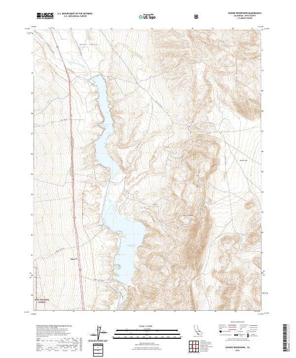
2021 Map of Haiwee Reservoirs
USGS Topo · Published 2021About this map
The Los Angeles Aqueduct and its companion, the Second Los Angeles Aqueduct, dominate this arid corridor where the southern Owens Valley transitions toward the Mojave Desert. The engineering of these water systems is anchored by the North Haiwee Reservoir and South Haiwee Reservoir, which sit at the base of the Coso Range. The small settlement of Haiwee remains a central point of reference near the reservoir's western shore, positioned along a network of local access routes including Haiwee Canyon Rd and Sage Flat Rd. This landscape is one of stark geographic boundaries, with the Inyo National Forest occupying the western foothills and Haiwee Ridge rising to the east. The map captures a high-desert environment defined by its role in California's water infrastructure, featuring landmarks like Cactus Flat and the drainage of Summit Cr.
Find a feature on this map
27 named features on this map. Tap any name to fly to it.
Don’t see what you’re looking for? This feature index may not catch every label — zoom into the map to look around manually.
Map Details
Editions of this 2021 Haiwee Reservoirs Map
This is the sole edition of this map. No revisions or reprints were ever made.
Other maps of this area

1905 · Olancha
USGS Topo · 1:125,000

1907 · Olancha
USGS Topo · 1:125,000

1908 · Ballarat
USGS Topo · 1:250,000

1913 · Ballarat
USGS Topo · 1:250,000

1948 · Death Valley
USGS Topo · 1:250,000

1948 · Fresno
USGS Topo · 1:250,000

1951 · Keeler
USGS Topo · 1:62,500

1951 · Haiwee Reservoir
USGS Topo · 1:62,500

1954 · Death Valley
USGS Topo · 1:250,000

1955 · Fresno
USGS Topo · 1:250,000