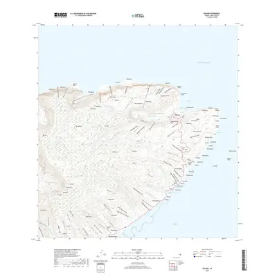
2017 Map of Halawa
USGS Topo · Published 2017About this map
Hālawa and the surrounding eastern valleys of Molokai are defined by a network of steep coastal gulches and dramatic waterfalls that descend toward the Pacific Ocean. This 2017 survey shows the traditional settlement patterns near Hālawa Bay, where Halawa Stream meets the sea. The landscape is characterized by narrow fertile valleys such as Papalaua Valley and Hālawa Valley, which have historically supported agriculture and small communities like Kuala.
Find a feature on this map
149 named features on this map. Tap any name to fly to it.
Don’t see what you’re looking for? This feature index may not catch every label — zoom into the map to look around manually.
Map Details
Editions of this 2017 Halawa Map
This is the sole edition of this map. No revisions or reprints were ever made.
Other maps of this area

1952 · Halawa
USGS Topo · 1:24,000

1952 · Kamalo
USGS Topo · 1:24,000

1954 · Maui
USGS Topo · 1:250,000

1956 · Honolua
USGS Topo · 1:24,000

1966 · Maui
USGS Topo · 1:250,000

1968 · Halawa
USGS Topo · 1:24,000
1968 · Kamalo
USGS Topo · 1:24,000

1974 · Maui
USGS Topo · 1:250,000
1983 · Molokai East
USGS Topo · 1:25,000
1983 · Honolua
USGS Topo · 1:24,000