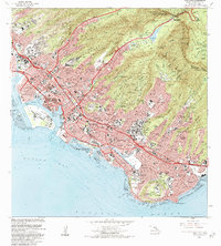
1983 Map of Honolua
USGS Topo · Published 1984About this map
The dense urban grid of Honolulu and its residential valleys is mapped here as it appeared in the early 1980s, revealing the complex layers of Hawaii's capital. From the maritime hubs of Honolulu Harbor and Keehi Lagoon to the steep ridges of the Koolau Range, the map illustrates a city defined by both its volcanic geography and its military and educational significance. High-visibility landmarks such as the Punchbowl crater, home to the National Memorial Cemetery of the Pacific, and the Diamond Head State Monument anchor the southern coastline.
Find a feature on this map
115 named features on this map. Tap any name to fly to it.
Don’t see what you’re looking for? This feature index may not catch every label — zoom into the map to look around manually.
Map Details
Editions of this 1983 Honolua Map
2 editions found
Other maps of this area

1952 · Halawa
USGS Topo · 1:24,000

1954 · Maui
USGS Topo · 1:250,000

1955 · Wailuku
USGS Topo · 1:24,000

1955 · Kahakuloa
USGS Topo · 1:24,000

1956 · Lahaina
USGS Topo · 1:24,000

1956 · Honolua
USGS Topo · 1:24,000

1966 · Maui
USGS Topo · 1:250,000

1968 · Halawa
USGS Topo · 1:24,000

1974 · Maui
USGS Topo · 1:250,000

1977 · Wailuku
USGS Topo · 1:24,000