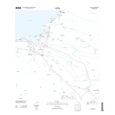
2013 Map of Haleiwa
USGS Topo · Published 2013About this map
The North Shore of O'ahu is defined by its complex irrigation network and coastal settlements as they appeared in 2013. The map traces the critical water infrastructure that once fueled the island's agriculture, including the Wahiawā Reservoir Ditch, Helemano Reservoir Ditch, and 'Opae'ula Ditch, which channel water from the interior gulches toward the coastal plains. Significant residential and historical centers like Hale‘iwa and Waialua sit at the confluence of the Paukauila Stream and 'Anahulu River, where the Hale‘iwa Boat Harbor and Hale‘iwa Bridge mark the transition from river to sea. Moving inland, the landscape is dotted with worker settlements and industrial remnants such as Ranch Camp, Kemo‘o Camp, and Thompson Corner, reflecting the region's plantation history. Notable landmarks like Weed Circle and the Hale‘iwa Army Beach provide specific points of interest for local historians and genealogists tracking the evolution of this storied coastline.
Find a feature on this map
128 named features on this map. Tap any name to fly to it.
Don’t see what you’re looking for? This feature index may not catch every label — zoom into the map to look around manually.
Map Details
Editions of this 2013 Haleiwa Map
This is the sole edition of this map. No revisions or reprints were ever made.
Other maps of this area

1952 · Waimea
USGS Topo · 1:24,000

1953 · Haleiwa
USGS Topo · 1:24,000

1953 · Schofield Barracks
USGS Topo · 1:24,000

1953 · Hauula
USGS Topo · 1:24,000

1954 · Oahu
USGS Topo · 1:250,000

1954 · Waianae
USGS Topo · 1:24,000

1954 · Kahuku
USGS Topo · 1:24,000

1954 · Kaena
USGS Topo · 1:24,000

1954 · Waipahu
USGS Topo · 1:24,000

1959 · Waipahu
USGS Topo · 1:24,000