
1954 Map of Kahuku
USGS Topo · Published 1955About this map
Kahuku and its industrial Sugar Mill dominate the northern coast of Oahu during the mid-1950s, a period when the landscape balanced agricultural production with recent military history. The map captures the presence of the Hawaii Infantry Training Camp and the Kahuku Airfield (Abandoned) near Kahuku Pt, alongside infrastructure like the Kahuku Radio Range Sta. To the southeast, the settlement of Laie is anchored by the Laie Temple, while a nearby Quarry and various reservoirs suggest the active management of the land.
Find a feature on this map
45 named features on this map. Tap any name to fly to it.
Don’t see what you’re looking for? This feature index may not catch every label — zoom into the map to look around manually.
Map Details
Editions of this 1954 Kahuku Map
This is the sole edition of this map. No revisions or reprints were ever made.
Other maps of this area

1952 · Waimea
USGS Topo · 1:24,000

1953 · Haleiwa
USGS Topo · 1:24,000

1953 · Hauula
USGS Topo · 1:24,000

1954 · Oahu
USGS Topo · 1:250,000

1954 · Kahana
USGS Topo · 1:24,000

1960 · Haleiwa
USGS Topo · 1:24,000

1961 · Oahu
USGS Topo · 1:250,000

1965 · Oahu
USGS Topo · 1:250,000
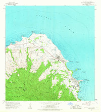
1965 · Kahuku
USGS Topo · 1:24,000
1966 · Waimea
USGS Topo · 1:24,000