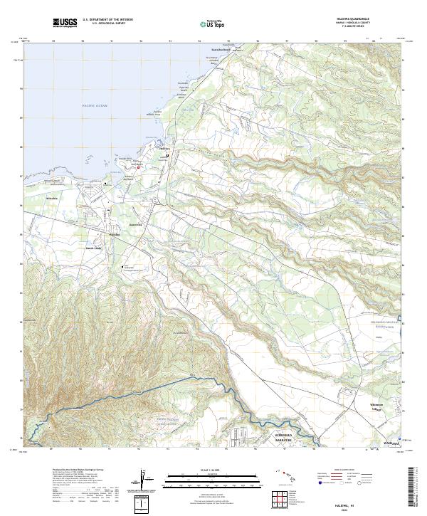
2024 Map of Haleiwa
USGS Topo · Published 2024About this map
Haleʙiwa and the surrounding north shore of O’ahu present a landscape defined by its coastal settlements and the extensive irrigation systems of its former agricultural heritage. The intersection of the Anahulu River and Paukauila Stream at Waialua Bay serves as a geographic anchor for the region, where coastal features like Puaʙena and Maeaea Point meet the inland reaches of Kamoʙoloa and Waialua. Evidence of a sophisticated water-management history is found in the network of the Wahiawā Reservoir Ditch, Wilson Ditch, and several reservoirs such as Opaeʙula Reservoir. The southern portion of the map transitions into significant federal and military lands, including portions of Schofield Barracks, the Helemano Military Reservation, and the Tropic Regions Test Center, illustrating the island's strategic role. For genealogists, several local burial sites are documented, notably the Liliʙokalani Church Cem and the Saint Michael the Archangel Catholic Cem.
Find a feature on this map
118 named features on this map. Tap any name to fly to it.
Don’t see what you’re looking for? This feature index may not catch every label — zoom into the map to look around manually.
Map Details
Editions of this 2024 Haleiwa Map
This is the sole edition of this map. No revisions or reprints were ever made.
Other maps of this area

1952 · Waimea
USGS Topo · 1:24,000

1953 · Haleiwa
USGS Topo · 1:24,000

1953 · Schofield Barracks
USGS Topo · 1:24,000

1953 · Hauula
USGS Topo · 1:24,000

1954 · Oahu
USGS Topo · 1:250,000

1954 · Waianae
USGS Topo · 1:24,000

1954 · Kahuku
USGS Topo · 1:24,000

1954 · Kaena
USGS Topo · 1:24,000

1954 · Waipahu
USGS Topo · 1:24,000

1959 · Waipahu
USGS Topo · 1:24,000