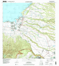
1999 Map of Haleiwa
USGS Topo · Published 2000About this map
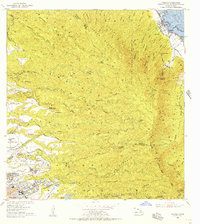
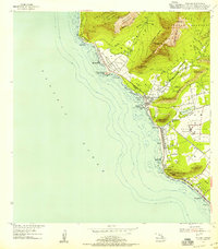
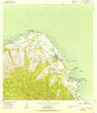
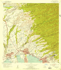
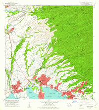
The coastal North Shore of O‘ahu centers on the settlement of Hale‘iwa and the agricultural hub of Waialua, where a prominent Sugar Mill serves as a landmark of the region's plantation history. The landscape is defined by the transition from the Pacific Ocean beaches, such as Kawailoa Beach, to the deeply incised gulches of the inland plateau. Extensive irrigation infrastructure, including the Opae‘ula 2 Res and various pumping stations, supports the legacy of sugar production in areas like Pa‘ala‘a Kai. To the south, the terrain rises toward the Ka‘ala Natural Area Reserve and the expansive Schofield Barracks Military Reservation. This 1999 update captures the area's mix of residential growth, such as Whitmore Village, and ancient cultural sites including the Kūkaniloko Birthstones State Monument, located near the intersection of the Waialua and Wahiawa districts.
Find a feature on this map
63 named features on this map. Tap any name to fly to it.
Don’t see what you’re looking for? This feature index may not catch every label — zoom into the map to look around manually.
Map Details
Editions of this 1999 Haleiwa Map
This is the sole edition of this map. No revisions or reprints were ever made.
Other maps of this area
1952 · Waimea
USGS Topo · 1:24,000
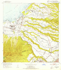
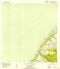
1953 · Haleiwa
USGS Topo · 1:24,000
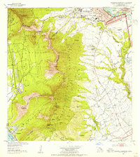
1953 · Schofield Barracks
USGS Topo · 1:24,000
1953 · Hauula
USGS Topo · 1:24,000

1954 · Oahu
USGS Topo · 1:250,000
1954 · Waianae
USGS Topo · 1:24,000
1954 · Kahuku
USGS Topo · 1:24,000

1954 · Kaena
USGS Topo · 1:24,000
1954 · Waipahu
USGS Topo · 1:24,000
1959 · Waipahu
USGS Topo · 1:24,000