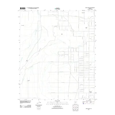
2011 Map of Haley Hills
USGS Topo · Published 2011About this map
Vekol Wash and Waterman Wash dominate the desert floor of this southwestern landscape, tracing the drainage patterns that define the Vekol Valley. The terrain rises toward the namesake Haley Hills and the Booth Hills, providing a clear record of the topographical features that dictate local land use. While much of the area remains open desert, scattered developments such as G M Ranch and the Donnelly Residence illustrate the presence of rural ranching and residential life in this part of Maricopa County.
Find a feature on this map
70 named features on this map. Tap any name to fly to it.
Don’t see what you’re looking for? This feature index may not catch every label — zoom into the map to look around manually.
Map Details
Editions of this 2011 Haley Hills Map
This is the sole edition of this map. No revisions or reprints were ever made.
Other maps of this area

1913 · Maricopa
USGS Topo · 1:62,500

1915 · Maricopa
USGS Topo · 1:62,500

1946 · Antelope Peak
USGS Topo · 1:62,500

1948 · Antelope Peak
USGS Topo · 1:62,500

1951 · Estrella
USGS Topo · 1:62,500

1951 · Mobile
USGS Topo · 1:62,500

1952 · Maricopa
USGS Topo · 1:24,000

1952 · Enid
USGS Topo · 1:24,000
1952 · Maricopa
USGS Topo · 1:62,500

1953 · Ajo
USGS Topo · 1:250,000