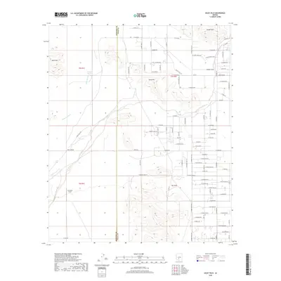
2018 Map of Haley Hills
USGS Topo · Published 2018About this map
Hidden Valley and the Haley Hills define this arid landscape along the border of Maricopa and Pinal Counties. The area is characterized by a sparse grid of rural roads and the dramatic rising topography of the Booth Hills and Papago Butte. The drainage patterns of the Vekol Wash and Waterman Wash dominate the lower elevations, highlighting the seasonal water flow essential to this desert environment. Human activity is marked by scattered infrastructure like the G M Ranch Airport and remote water points such as Poverty Flat Tank. This 2018 survey reveals the steady encroachment of residential naming conventions onto the desert floor, with numerous planned road names like W Quail Run Rd and W Dove Dr overlaying the traditional landscape of the Vekol Valley.
Find a feature on this map
89 named features on this map. Tap any name to fly to it.
Don’t see what you’re looking for? This feature index may not catch every label — zoom into the map to look around manually.
Map Details
Editions of this 2018 Haley Hills Map
This is the sole edition of this map. No revisions or reprints were ever made.
Other maps of this area

1913 · Maricopa
USGS Topo · 1:62,500

1915 · Maricopa
USGS Topo · 1:62,500

1946 · Antelope Peak
USGS Topo · 1:62,500

1948 · Antelope Peak
USGS Topo · 1:62,500

1951 · Estrella
USGS Topo · 1:62,500

1951 · Mobile
USGS Topo · 1:62,500

1952 · Maricopa
USGS Topo · 1:24,000

1952 · Enid
USGS Topo · 1:24,000
1952 · Maricopa
USGS Topo · 1:62,500

1953 · Ajo
USGS Topo · 1:250,000