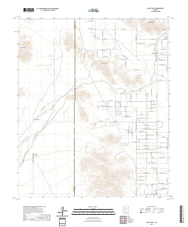
2021 Map of Haley Hills
USGS Topo · Published 2021About this map
Haley Hills and the Booth Hills rise above a landscape defined by the intersection of ephemeral desert drainages and modern rural settlement. In this corner of Pinal County, the westward-flowing Vekol Wash and Waterman Wash cut across the arid terrain, creating natural corridors that have influenced land use for generations. The area includes the community of Hidden Valley, where a grid of residential roads like W Mayer Blvd and W Esch Trl indicates contemporary growth within the desert.
Find a feature on this map
86 named features on this map. Tap any name to fly to it.
Don’t see what you’re looking for? This feature index may not catch every label — zoom into the map to look around manually.
Map Details
Editions of this 2021 Haley Hills Map
This is the sole edition of this map. No revisions or reprints were ever made.
Other maps of this area

1913 · Maricopa
USGS Topo · 1:62,500

1915 · Maricopa
USGS Topo · 1:62,500

1946 · Antelope Peak
USGS Topo · 1:62,500

1948 · Antelope Peak
USGS Topo · 1:62,500

1951 · Estrella
USGS Topo · 1:62,500

1951 · Mobile
USGS Topo · 1:62,500

1952 · Maricopa
USGS Topo · 1:24,000

1952 · Enid
USGS Topo · 1:24,000
1952 · Maricopa
USGS Topo · 1:62,500

1953 · Ajo
USGS Topo · 1:250,000