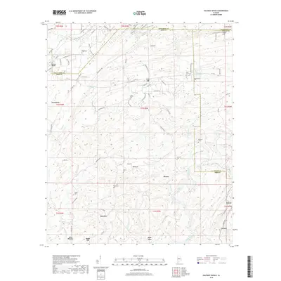
2018 Map of Halfmile Shoals
USGS Topo · Published 2018About this map
Woodstock and West Blocton anchor a landscape defined by the winding course of the Cahaba River as it passes through the junction of Bibb, Jefferson, Shelby, and Tuscaloosa counties. The terrain transitions from the heights of Sand Mtn and Shades Mtn in the north toward the river's namesake features, Halfmile Shoals and Lilly Shoals. This area is marked by a series of small, well-established settlements including Gray Hill, Hebron, and Marvel, each connected by a network of county roads and distinctive local routes like the Pig Iron Loop and Iron Runner Loop.
Find a feature on this map
102 named features on this map. Tap any name to fly to it.
Don’t see what you’re looking for? This feature index may not catch every label — zoom into the map to look around manually.
Map Details
Editions of this 2018 Halfmile Shoals Map
This is the sole edition of this map. No revisions or reprints were ever made.
Other maps of this area

1890 · Bessemer
USGS Topo · 1:125,000

1892 · Bessemer
USGS Topo · 1:125,000

1899 · Brookwood
USGS Topo · 1:125,000

1905 · Bessemer Iron District
USGS Topo · 1:62,500

1907 · Bessemer Special
USGS Topo · 1:62,500

1910 · Montevallo
USGS Topo · 1:62,500

1927 · Adger
USGS Topo · 1:48,000

1932 · Yolande
USGS Topo · 1:62,500

1934 · Blocton
USGS Topo · 1:48,000

1935 · Yolande
USGS Topo · 1:62,500