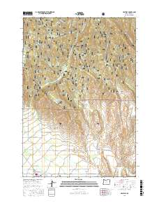
2017 Map of Halfway
USGS Topo · Published 2017About this map
Pine Valley serves as the focal point of this 2017 survey, where the town of Halfway sits at the junction of the Pine Creek Hwy and Cornucopia Hwy. The landscape transitions from the residential and agricultural plots near Sunset to the heavily forested slopes of the Whitman National Forest. Local history is embedded in the terrain through features like the Pine Haven Cem and the Mining Channel, the latter indicating the region's enduring connection to resource extraction. To the north and west, the topography rises toward Mehlhorn Butte and Bearwallow Ridge, while water management is evidenced by the Bearwallow Reservoir. A network of Forest Service roads, including NFD Road 66 Rd, provides access into the high country, tracing the drainages of Pine Cr and its various tributaries.
Find a feature on this map
55 named features on this map. Tap any name to fly to it.
Don’t see what you’re looking for? This feature index may not catch every label — zoom into the map to look around manually.
Map Details
Editions of this 2017 Halfway Map
This is the sole edition of this map. No revisions or reprints were ever made.
Other maps of this area

1915 · Pine
USGS Topo · 1:125,000

1954 · Cornucopia
USGS Topo · 1:62,500

1955 · Baker
USGS Topo · 1:250,000

1955 · Grangeville
USGS Topo · 1:250,000

1957 · Halfway
USGS Topo · 1:62,500

1957 · Homestead
USGS Topo · 1:62,500

1957 · Copperfield
USGS Topo · 1:62,500

1959 · Baker
USGS Topo · 1:250,000

1959 · Grangeville
USGS Topo · 1:250,000

1980 · McCall
USGS Topo · 1:100,000