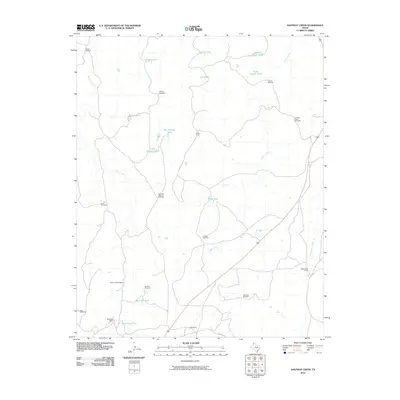
2010 Map of Halfway Creek
USGS Topo · Published 2010About this map
Water management dominates the landscape of the Texas Panhandle in this 2010 study, where life and industry depend on a sprawling network of windmills and tanks. Named camps such as Parker Camp and Cottonwood Camp are situated near the drainages of Halfway Creek and Parker Creek, indicating the historical and functional relationship between the land's hydrology and its ranching operations. The prevalence of features like Mansfield Ranch and the distinctive Leaning Tower Windmill underscores the importance of individual ranching legacies in Oldham County.
Find a feature on this map
33 named features on this map. Tap any name to fly to it.
Don’t see what you’re looking for? This feature index may not catch every label — zoom into the map to look around manually.
Map Details
Editions of this 2010 Halfway Creek Map
This is the sole edition of this map. No revisions or reprints were ever made.
Other maps of this area

1934 · Ady
USGS Topo · 1:62,500

1936 · Ady
USGS Topo · 1:62,500

1954 · Tucumcari
USGS Topo · 1:250,000

1958 · Tucumcari
USGS Topo · 1:250,000

1966 · Jay Taylor Ranch
USGS Topo · 1:24,000

1966 · Halfway Creek
USGS Topo · 1:24,000

1966 · Ady
USGS Topo · 1:24,000

1966 · Rotten Hill
USGS Topo · 1:24,000

1966 · Torrea Peak
USGS Topo · 1:24,000
1966 · Vega North
USGS Topo · 1:24,000