
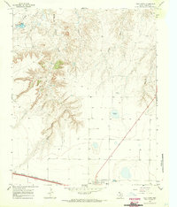
1966 Map of Halfway Creek
USGS Topo · Published 1969About this map
Mansfield Ranch and the historical Cottonwood Camp (Site) anchor this landscape in the Texas Panhandle, recorded just before the end of the 1960s. The terrain is defined by a dense network of water management features essential for cattle operations, including Big Halfway Tank, Horse Trap Tank, and numerous family or locality-named windmills such as Alamosa Windmill and Ranch Creek Windmill. These features suggest a high-plains ranching economy that relied heavily on seasonal drainages like Halfway Creek and Parker Creek.
Find a feature on this map
36 named features on this map. Tap any name to fly to it.
Don’t see what you’re looking for? This feature index may not catch every label — zoom into the map to look around manually.
Map Details
Editions of this 1966 Halfway Creek Map
This is the sole edition of this map. No revisions or reprints were ever made.
Other maps of this area

1934 · Ady
USGS Topo · 1:62,500

1936 · Ady
USGS Topo · 1:62,500

1954 · Tucumcari
USGS Topo · 1:250,000

1958 · Tucumcari
USGS Topo · 1:250,000

1966 · Jay Taylor Ranch
USGS Topo · 1:24,000

1966 · Ady
USGS Topo · 1:24,000

1966 · Rotten Hill
USGS Topo · 1:24,000

1966 · Torrea Peak
USGS Topo · 1:24,000
1966 · Vega North
USGS Topo · 1:24,000

1971 · Boys Ranch West
USGS Topo · 1:24,000