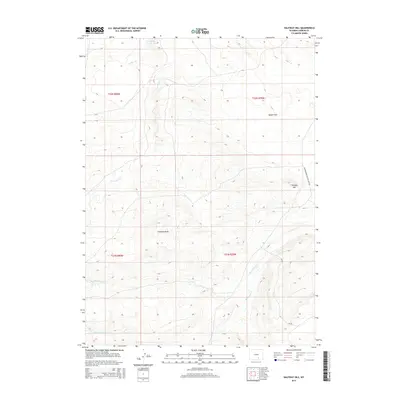
2015 Map of Halfway Hill
USGS Topo · Published 2015About this map
Smith Reservoir sits in the northern reaches of this Carbon County landscape, collecting the waters of Carbon Cr and First Sand Cr before they flow into the surrounding plains. The terrain is defined by a series of north-south drainage patterns, including Second Sand Cr and Third Sand Cr, which carve through the high-elevation flats. The eastern portion of the survey is dominated by the prominence of Halfway Hill, overlooking the broad expanse of Spade Flats. Transportation in this area is sparse, primarily centered on the Elk Mountain Medicine Bow Rd and Cr 320. The map reveals a highly structured ranching or grazing territory, marked by distinct township and range divisions such as t22n r80w and t21n r79w, and local geographic landmarks like Chapman Draw.
Find a feature on this map
14 named features on this map. Tap any name to fly to it.
Don’t see what you’re looking for? This feature index may not catch every label — zoom into the map to look around manually.
Map Details
Editions of this 2015 Halfway Hill Map
This is the sole edition of this map. No revisions or reprints were ever made.
Other maps of this area

1914 · Saddleback Hills
USGS Topo · 1:62,500

1915 · Como Ridge
USGS Topo · 1:48,000

1918 · Como Ridge
USGS Topo · 1:62,500

1921 · Saddleback Hills
USGS Topo · 1:62,500

1954 · Rawlins
USGS Topo · 1:250,000

1955 · Elk Mountain
USGS Topo · 1:24,000

1958 · Rawlins
USGS Topo · 1:250,000

1958 · Mc Fadden
USGS Topo · 1:24,000

1958 · T L Ranch
USGS Topo · 1:24,000

1962 · Rawlins
USGS Topo · 1:250,000