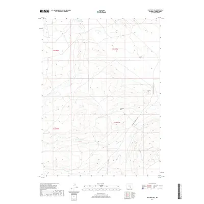
2017 Map of Halfway Hill
USGS Topo · Published 2017About this map
Smith Reservoir sits at the northern edge of this high-desert landscape in Carbon County, representing a critical water source in an arid region defined by intermittent drainage systems. The terrain is structured around several significant watercourses including Carbon Cr, First Sand Cr, and Second Sand Cr, which carve through the high plains toward the Spade Flats. Transportation through this remote stretch of Wyoming is primarily facilitated by the Elk Mountain Medicine Bow Rd and secondary routes like Co Rd 120. Notable landforms such as Halfway Hill and the long depression of Chapman Draw dictate the local topography, offering a clear view of the rural ranching and resource management environment as it appeared in the early 21st century.
Find a feature on this map
15 named features on this map. Tap any name to fly to it.
Don’t see what you’re looking for? This feature index may not catch every label — zoom into the map to look around manually.
Map Details
Editions of this 2017 Halfway Hill Map
This is the sole edition of this map. No revisions or reprints were ever made.
Other maps of this area

1914 · Saddleback Hills
USGS Topo · 1:62,500

1915 · Como Ridge
USGS Topo · 1:48,000

1918 · Como Ridge
USGS Topo · 1:62,500

1921 · Saddleback Hills
USGS Topo · 1:62,500

1954 · Rawlins
USGS Topo · 1:250,000

1955 · Elk Mountain
USGS Topo · 1:24,000

1958 · Rawlins
USGS Topo · 1:250,000

1958 · Mc Fadden
USGS Topo · 1:24,000

1958 · T L Ranch
USGS Topo · 1:24,000

1962 · Rawlins
USGS Topo · 1:250,000