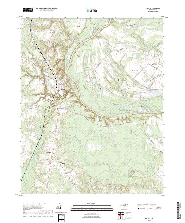
2022 Map of Halifax
USGS Topo · Published 2022About this map
The Halifax County Courthouse serves as the focal point of the historic seat of Halifax, North Carolina, situated on a high bend where Quankey Creek meets the Roanoke River. This modern survey reveals a landscape deeply influenced by the wide, winding river valley, which separates Halifax County from Northampton County and defines the fertile peninsula of Occoneechee Neck.
Find a feature on this map
46 named features on this map. Tap any name to fly to it.
Don’t see what you’re looking for? This feature index may not catch every label — zoom into the map to look around manually.
Map Details
Editions of this 2022 Halifax Map
This is the sole edition of this map. No revisions or reprints were ever made.
Other maps of this area

1953 · Norfolk
USGS Topo · 1:250,000

1960 · Dawson Crossroads
USGS Topo · 1:24,000

1961 · Enfield
USGS Topo · 1:24,000

1962 · Scotland Neck
USGS Topo · 1:24,000

1974 · Halifax
USGS Topo · 1:24,000

1974 · Boones Crossroads
USGS Topo · 1:24,000
1974 · Roanoke Rapids
USGS Topo · 1:24,000
1974 · Weldon
USGS Topo · 1:24,000

1974 · Darlington
USGS Topo · 1:24,000
1974 · Jackson
USGS Topo · 1:24,000