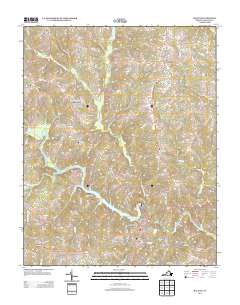
2013 Map of Halifax
USGS Topo · Published 2013About this map
The town of Halifax, serving as a central hub for this portion of Virginia, sits at the confluence of several regional roads just south of the Banister River. The landscape is defined by the winding waters of Banister Lake and its many tributaries, including the curiously named Terrible Cr and Little Terrible Cr to the north. Settlement patterns follow the high ground between these drainages, with small communities like Crystal Hill, Dudley, and Youngers Store anchored by local intersections.
Find a feature on this map
111 named features on this map. Tap any name to fly to it.
Don’t see what you’re looking for? This feature index may not catch every label — zoom into the map to look around manually.
Map Details
Editions of this 2013 Halifax Map
This is the sole edition of this map. No revisions or reprints were ever made.
Other maps of this area

1952 · Milton
USGS Topo · 1:62,500

1953 · South Boston
USGS Topo · 1:62,500

1953 · Greensboro
USGS Topo · 1:250,000

1954 · Greensboro
USGS Topo · 1:250,000

1954 · Halifax
USGS Topo · 1:62,500

1954 · Riceville
USGS Topo · 1:62,500

1956 · Milton
USGS Topo · 1:62,500

1957 · South Boston
USGS Topo · 1:62,500

1962 · Greensboro
USGS Topo · 1:250,000

1966 · Greensboro
USGS Topo · 1:250,000