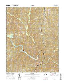
2016 Map of Halifax
USGS Topo · Published 2016About this map
Halifax serves as the focal point of this Halifax County landscape, situated along the southern banks of the Banister River where it widens into Banister Lake. The town's historical layout is anchored by the Halifax Town Cem, while the surrounding countryside is defined by a network of smaller settlements such as Crystal Hill, McKendree, and Dudley. This 2016 survey illustrates a rural Virginia economy deeply tied to the land, shown through a dense web of local tracks and lanes like Woodbourne Rd, Cedar Fork Rd, and Murphy Grove Rd that connect isolated farmsteads and family-named landmarks.
Find a feature on this map
97 named features on this map. Tap any name to fly to it.
Don’t see what you’re looking for? This feature index may not catch every label — zoom into the map to look around manually.
Map Details
Editions of this 2016 Halifax Map
This is the sole edition of this map. No revisions or reprints were ever made.
Other maps of this area

1952 · Milton
USGS Topo · 1:62,500

1953 · South Boston
USGS Topo · 1:62,500

1953 · Greensboro
USGS Topo · 1:250,000

1954 · Greensboro
USGS Topo · 1:250,000

1954 · Halifax
USGS Topo · 1:62,500

1954 · Riceville
USGS Topo · 1:62,500

1956 · Milton
USGS Topo · 1:62,500

1957 · South Boston
USGS Topo · 1:62,500

1962 · Greensboro
USGS Topo · 1:250,000

1966 · Greensboro
USGS Topo · 1:250,000