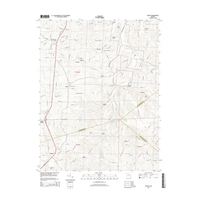
2015 Map of Halifax
USGS Topo · Published 2015About this map
Valles Mines and the settlement of Halifax define the southern landscape of this Missouri quadrangle, situated where the borders of Jefferson, St. Francois, and Ste. Genevieve counties converge. The area is characterized by a dense concentration of family and community burial grounds, such as the Old German Cemetery and Byrd Cemetery, which offer significant value for genealogical research. The terrain is marked by distinct geological features like Saltpeter Hollow and McMullen Ridge, while the northern portion features smaller settlements like Flucom and Oakvale. The drainage network, including Plattin Creek and the W Fork Plattin Cr, reveals a rural development pattern of dispersed farmsteads and narrow hollows. Notable landmarks like the Aire Parque Airport and Harmons Farm Pond reflect the modern land use in this traditionally agricultural and mining-influenced region.
Find a feature on this map
113 named features on this map. Tap any name to fly to it.
Don’t see what you’re looking for? This feature index may not catch every label — zoom into the map to look around manually.
Map Details
Editions of this 2015 Halifax Map
This is the sole edition of this map. No revisions or reprints were ever made.
Other maps of this area

1901 · De Soto
USGS Topo · 1:125,000

1904 · Farmington
USGS Topo · 1:62,500

1905 · Bonneterre
USGS Topo · 1:62,500

1906 · Farmington
USGS Topo · 1:62,500

1915 · Crystal City
USGS Topo · 1:62,500

1930 · De Soto NE
USGS Topo · 1:24,000

1931 · De Soto SE
USGS Topo · 1:24,000

1949 · Saint Louis
USGS Topo · 1:250,000

1949 · Rolla
USGS Topo · 1:250,000

1949 · Crystal City
USGS Topo · 1:62,500