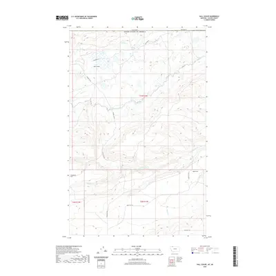
2020 Map of Hall Coulee
USGS Topo · Published 2020About this map
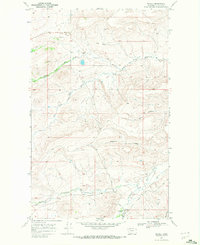
The international boundary between Canada and the United States defines the northern edge of this landscape in Glacier County, where the plains of northern Montana meet the drainage systems of the High Divide. Central to the area is the Saint Mary Canal, a critical piece of water infrastructure that winds through the terrain alongside the Canal Trl. The map details a complex network of seasonal watercourses and coulees, including Willow Cr, Cow Cr, and the N Fork Milk River. High-elevation plateaus like Freezeout Flat and Pikuni Flat overlook the descent into the namesake Hall Coulee. Backcountry access is documented via established routes such as Whiskey Gap Rd and Weathered Rd, which follow the natural contours of the land through sections like t37n r12w.
Find a feature on this map
18 named features on this map. Tap any name to fly to it.
Don’t see what you’re looking for? This feature index may not catch every label — zoom into the map to look around manually.
Map Details
Editions of this 2020 Hall Coulee Map
This is the sole edition of this map. No revisions or reprints were ever made.
Other maps of this area

1901 · Browning
USGS Topo · 1:125,000

1903 · Browning
USGS Topo · 1:125,000

1960 · Cut Bank
USGS Topo · 1:250,000

1963 · Cut Bank
USGS Topo · 1:250,000

1964 · Cut Bank
USGS Topo · 1:250,000

1968 · Hoodoo Hill
USGS Topo · 1:24,000
1968 · Duck Lake
USGS Topo · 1:24,000
1968 · Emigrant Gap
USGS Topo · 1:24,000
1968 · Hall Coulee
USGS Topo · 1:24,000
1968 · Wetzel
USGS Topo · 1:24,000