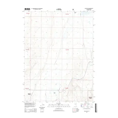
2015 Map of Halleck SW
USGS Topo · Published 2015About this map
Lamoille Valley serves as the focal point for this high-desert landscape in Elko County, where seasonal drainages descend from the elevated terrain of the Humboldt National Forest. The map documents the rural-residential character of Spring Creek in the southwest, showing a grid of local access roads such as Bottari Ranch Rd and Clubine Rd that service ranching and residential parcels.
Find a feature on this map
26 named features on this map. Tap any name to fly to it.
Don’t see what you’re looking for? This feature index may not catch every label — zoom into the map to look around manually.
Map Details
Editions of this 2015 Halleck SW Map
This is the sole edition of this map. No revisions or reprints were ever made.
Other maps of this area

1935 · Halleck
USGS Topo · 1:125,000

1955 · Elko
USGS Topo · 1:250,000

1958 · Elko
USGS Topo · 1:250,000

1962 · Elko
USGS Topo · 1:250,000

1962 · Boyd Reservoir
USGS Topo · 1:24,000

1962 · Ryndon
USGS Topo · 1:24,000

1962 · Lee
USGS Topo · 1:62,500

1962 · Lamoille
USGS Topo · 1:62,500

1965 · Elko
USGS Topo · 1:250,000
1970 · Soldier Peak
USGS Topo · 1:24,000