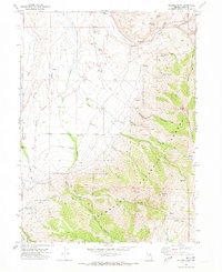
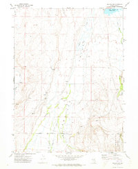
1970 Map of Soldier Peak
USGS Topo · Published 1973About this map
Fort Halleck Cem and the nearby Fort Halleck Historical Marker anchor this 1970s look at the high desert terrain of Elko County. The map details the eastern edge of the Old Military Reservation Boundary, tracing the historical footprint of the fort near the confluence of Soldier Creek and Wilson Creek. The landscape transitions from the flatlands near the Landing Strip into the steep, complex drainages of the Humboldt National Forest. High peaks including Soldier Peak and Secret Peak tower over a network of routes such as the Soldier Trail and various unnamed pack trails. The presence of numerous named water sources like Emigrant Spring, Moopie Spring, and Gheen Spring illustrates the critical role of reliable water in this part of the Ruby Mountains, while features like Bills Fishpond and several borrow pits show local human modification of the natural environment.
Find a feature on this map
45 named features on this map. Tap any name to fly to it.
Don’t see what you’re looking for? This feature index may not catch every label — zoom into the map to look around manually.
Map Details
Editions of this 1970 Soldier Peak Map
This is the sole edition of this map. No revisions or reprints were ever made.
Other maps of this area

1935 · Halleck
USGS Topo · 1:125,000

1955 · Elko
USGS Topo · 1:250,000

1958 · Elko
USGS Topo · 1:250,000

1962 · Elko
USGS Topo · 1:250,000

1962 · Lamoille
USGS Topo · 1:62,500

1965 · Elko
USGS Topo · 1:250,000
1969 · Secret Valley
USGS Topo · 1:24,000
1969 · Tent Mountain
USGS Topo · 1:24,000
1971 · Heelfly Creek
USGS Topo · 1:24,000
1971 · Halleck SW
USGS Topo · 1:24,000