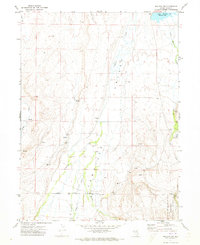
1971 Map of Halleck SW
USGS Topo · Published 1973About this map
Lamoille Valley defines this high-desert landscape in northeastern Nevada, showing a complex network of seasonal drainage and ranching infrastructure as it stood in the early 1970s. The terrain is marked by a series of intermittent and perennial water sources, including Lamoille Creek, John Day Creek, and Rabbit Creek, which supported the livestock operations evidenced by a Corral and various Borrow Pits near the mountains. The presence of Bills Fishpond and Hoopers Dam suggests local water management for agriculture or recreation, while Lake Phyllis sits at the northern edge of the survey.
Find a feature on this map
22 named features on this map. Tap any name to fly to it.
Don’t see what you’re looking for? This feature index may not catch every label — zoom into the map to look around manually.
Map Details
Editions of this 1971 Halleck SW Map
This is the sole edition of this map. No revisions or reprints were ever made.
Other maps of this area

1935 · Halleck
USGS Topo · 1:125,000

1955 · Elko
USGS Topo · 1:250,000

1958 · Elko
USGS Topo · 1:250,000

1962 · Elko
USGS Topo · 1:250,000

1962 · Boyd Reservoir
USGS Topo · 1:24,000

1962 · Ryndon
USGS Topo · 1:24,000

1962 · Lee
USGS Topo · 1:62,500

1962 · Lamoille
USGS Topo · 1:62,500

1965 · Elko
USGS Topo · 1:250,000
1970 · Soldier Peak
USGS Topo · 1:24,000