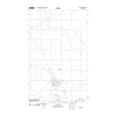
2010 Map of Hallock
USGS Topo · Published 2010About this map
The town of Hallock serves as the central hub for this corner of Kittson County, where the convergence of several waterways dictates the layout of the land. Situated at the junction of Two Rivers and the North Branch Two Rivers, the settlement is flanked by residential developments like Viking Land Terrace and essential local services including the Hallock Post Office. The landscape is a patchwork of section lines and township roads, with specialized transit points such as the Hallock Municipal Airport and the private Maurice Sugden Flying Service Strip serving the agricultural community.
Find a feature on this map
43 named features on this map. Tap any name to fly to it.
Don’t see what you’re looking for? This feature index may not catch every label — zoom into the map to look around manually.
Map Details
Editions of this 2010 Hallock Map
This is the sole edition of this map. No revisions or reprints were ever made.
Other maps of this area

1939 · Drayton
USGS Topo · 1:62,500

1939 · Pembina
USGS Topo · 1:62,500

1939 · Kennedy
USGS Topo · 1:62,500

1941 · Kennedy
USGS Topo · 1:62,500

1941 · Drayton
USGS Topo · 1:62,500

1941 · Hallock
USGS Topo · 1:62,500

1941 · Pembina
USGS Topo · 1:62,500

1952 · Thief River Falls
USGS Topo · 1:250,000

1956 · Thief River Falls
USGS Topo · 1:250,000

1957 · Thief River Falls
USGS Topo · 1:250,000