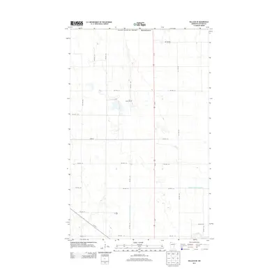
2013 Map of Hallock NE
USGS Topo · Published 2013About this map
The international border between the United States of America and Canada defines the northern limit of this Kittson County landscape. Characterized by the precise geometric grid of the township road system, including routes like Twp Hwy T-55 and Twp Hwy T-61, the area is primarily agricultural. Evidence of early family settlement remains in the small, localized burial grounds such as Tom Lako Farm Cem, Holy Rosary Cem, and Sikar Cem. These sites reflect the genealogy of the rural population during a period of modern land management. Water drainage is heavily engineered in this flat terrain, most notably via State Ditch Number Eightyfour, which cuts across the township lines to manage the hydrology of the Red River Valley region.
Find a feature on this map
24 named features on this map. Tap any name to fly to it.
Don’t see what you’re looking for? This feature index may not catch every label — zoom into the map to look around manually.
Map Details
Editions of this 2013 Hallock NE Map
This is the sole edition of this map. No revisions or reprints were ever made.
Other maps of this area

1918 · Hemmington
USGS Topo · 1:62,500

1941 · Hallock
USGS Topo · 1:62,500

1952 · Thief River Falls
USGS Topo · 1:250,000

1956 · Thief River Falls
USGS Topo · 1:250,000

1957 · Thief River Falls
USGS Topo · 1:250,000

1966 · Skull Lake
USGS Topo · 1:24,000
1966 · Skull Lake SW
USGS Topo · 1:24,000

1967 · Thief River Falls
USGS Topo · 1:250,000
1974 · Hallock NE
USGS Topo · 1:24,000
1974 · Orleans
USGS Topo · 1:24,000