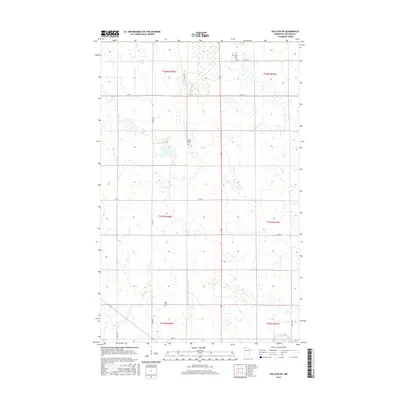
2016 Map of Hallock NE
USGS Topo · Published 2016About this map
Agricultural patterns and water management define this portion of Kittson County, where the landscape is organized by a precise grid of rural roads and drainage infrastructure. State Ditch Number Eightyfour serves as a primary artery for the region's complex water system, cutting through the township boundaries of T163N and T162N. This rural expanse is punctuated by small, significant local landmarks that provide insight into the area's social history and family legacies. For genealogists and local historians, the presence of Tom Lako Farm Cem, Holy Rosary Cem, and Sikar Cem offers tangible connections to the early settlers and farming families of the northern Red River Valley region. These sites remain anchored among established thoroughfares like Co Rd 56 and Co Rd 8, illustrating the enduring nature of rural settlement in extreme northwestern Minnesota.
Find a feature on this map
21 named features on this map. Tap any name to fly to it.
Don’t see what you’re looking for? This feature index may not catch every label — zoom into the map to look around manually.
Map Details
Editions of this 2016 Hallock NE Map
This is the sole edition of this map. No revisions or reprints were ever made.
Other maps of this area

1918 · Hemmington
USGS Topo · 1:62,500

1941 · Hallock
USGS Topo · 1:62,500

1952 · Thief River Falls
USGS Topo · 1:250,000

1956 · Thief River Falls
USGS Topo · 1:250,000

1957 · Thief River Falls
USGS Topo · 1:250,000

1966 · Skull Lake
USGS Topo · 1:24,000
1966 · Skull Lake SW
USGS Topo · 1:24,000

1967 · Thief River Falls
USGS Topo · 1:250,000
1974 · Hallock NE
USGS Topo · 1:24,000
1974 · Orleans
USGS Topo · 1:24,000