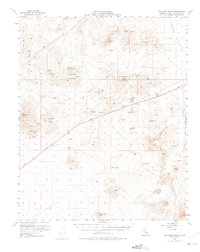
1956 Map of Halloran Spring
USGS Topo · Published 1975About this map
Turquoise Mountain and the surrounding Silurian Hills anchor this mid-century survey of the California high desert, where mining activity and transit corridors define the landscape. The map captures a moment of infrastructure development, showing the 4 Lane highway cutting through the terrain alongside specialized landmarks like the Microwave Relay Sta VABM 4511 and the Airway Beacon 4391, which served early aviation and communication networks.
Find a feature on this map
43 named features on this map. Tap any name to fly to it.
Don’t see what you’re looking for? This feature index may not catch every label — zoom into the map to look around manually.
Map Details
Editions of this 1956 Halloran Spring Map
4 editions found

Other maps of this area

1910 · Ivanpah
USGS Topo · 1:250,000

1912 · Ivanpah
USGS Topo · 1:250,000

1933 · Avawatz Mountains
USGS Topo · 1:250,000

1942 · Ivanpah
USGS Topo · 1:250,000

1947 · Trona
USGS Topo · 1:250,000

1947 · Kingman
USGS Topo · 1:250,000

1948 · Kingman
USGS Topo · 1:250,000

1948 · Trona
USGS Topo · 1:250,000

1953 · Trona
USGS Topo · 1:250,000

1954 · Kingman
USGS Topo · 1:250,000