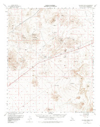
1956 Map of Halloran Spring
USGS Topo · Published 1985About this map
Turquoise Mountain and the surrounding high desert terrain define this mid-century survey of northeastern San Bernardino County. The landscape is heavily marked by the region's mineral history, featuring the Turquoise Mining Area and several remote operations such as the Great Wanamingo Mine, Pomona Mine, and the Jumbo Mine. Water sources were critical to these desert outposts, evidenced by the presence of Halloran Spring, Francis Spring, and Hytens Well. Small settlements and waypoints like Yucca Grove and Cree Camp sit along the primary transit route, which is noted as a 4 Lane highway. Technical infrastructure of the era is also visible, including a Microwave Relay Sta and an Airway Beacon, reflecting the intersection of traditional mining life with modern aviation and communication networks.
Find a feature on this map
36 named features on this map. Tap any name to fly to it.
Don’t see what you’re looking for? This feature index may not catch every label — zoom into the map to look around manually.
Map Details
Editions of this 1956 Halloran Spring Map
4 editions found

Other maps of this area

1910 · Ivanpah
USGS Topo · 1:250,000

1912 · Ivanpah
USGS Topo · 1:250,000

1933 · Avawatz Mountains
USGS Topo · 1:250,000

1942 · Ivanpah
USGS Topo · 1:250,000

1947 · Trona
USGS Topo · 1:250,000

1947 · Kingman
USGS Topo · 1:250,000

1948 · Kingman
USGS Topo · 1:250,000

1948 · Trona
USGS Topo · 1:250,000

1953 · Trona
USGS Topo · 1:250,000

1954 · Kingman
USGS Topo · 1:250,000