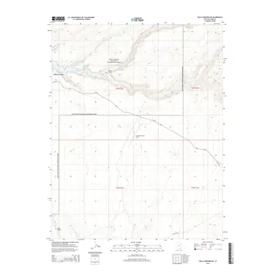
2014 Map of Halls Crossing NE
USGS Topo · Published 2014About this map
Halls Crossing and the surrounding high desert canyonlands are the focus of this modern survey of San Juan County. The landscape is dominated by the intricate shorelines of Lake Powell, which fills the deep incisions of the Colorado River basin and its tributaries. To the south, the map reveals the hydrological transition from the lake into Lake Canyon and the E Fork Lake Canyon, illustrating how the impounded water interacts with the natural drainage systems of the plateau.
Find a feature on this map
14 named features on this map. Tap any name to fly to it.
Don’t see what you’re looking for? This feature index may not catch every label — zoom into the map to look around manually.
Map Details
Editions of this 2014 Halls Crossing NE Map
This is the sole edition of this map. No revisions or reprints were ever made.
Other maps of this area

1886 · Henry Mountains
USGS Topo · 1:250,000

1892 · Henry Mountains
USGS Topo · 1:250,000

1952 · Mancos Mesa
USGS Topo · 1:62,500

1953 · Lake Canyon
USGS Topo · 1:62,500

1953 · Mt. Ellsworth
USGS Topo · 1:62,500

1954 · White Canyon 3 SW
USGS Topo · 1:24,000

1954 · Clay Hills 2 SW
USGS Topo · 1:24,000

1954 · Clay Hills 2 NW
USGS Topo · 1:24,000
1954 · Clay Hills
USGS Topo · 1:62,500

1956 · Escalante
USGS Topo · 1:250,000