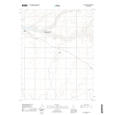
2020 Map of Halls Crossing NE
USGS Topo · Published 2020About this map
Lake Powell dominates the northern reaches of this map, representing the modern aquatic landscape within the Glen Canyon National Recreation Area. The settlement of Halls Crossing serves as a primary access point to the water, where the established Halls Crossing Rd meets the shoreline. The surrounding terrain is defined by dramatic drainage systems, including the steep-walled North Gulch and the E Fork Lake Canyon, which carve through the high desert plateau.
Find a feature on this map
9 named features on this map. Tap any name to fly to it.
Don’t see what you’re looking for? This feature index may not catch every label — zoom into the map to look around manually.
Map Details
Editions of this 2020 Halls Crossing NE Map
This is the sole edition of this map. No revisions or reprints were ever made.
Other maps of this area

1886 · Henry Mountains
USGS Topo · 1:250,000

1892 · Henry Mountains
USGS Topo · 1:250,000

1952 · Mancos Mesa
USGS Topo · 1:62,500

1953 · Lake Canyon
USGS Topo · 1:62,500

1953 · Mt. Ellsworth
USGS Topo · 1:62,500

1954 · White Canyon 3 SW
USGS Topo · 1:24,000

1954 · Clay Hills 2 SW
USGS Topo · 1:24,000

1954 · Clay Hills 2 NW
USGS Topo · 1:24,000
1954 · Clay Hills
USGS Topo · 1:62,500

1956 · Escalante
USGS Topo · 1:250,000