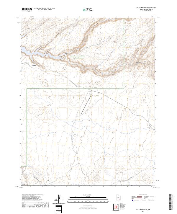
2023 Map of Halls Crossing NE
USGS Topo · Published 2023About this map
The high desert landscape of the Red Rock Plateau dominates this San Juan County survey, much of which is contained within the Glen Canyon National Recreation Area. The settlement at Halls Crossing serves as a primary access point for the region, connected by the Halls Crossing Access Road and the aviation facilities at Cal Black Memorial Airport. Deep incisions in the earth define the drainage patterns here, with North Gulch and the winding Moqui Canyon carving through the sandstone toward the Colorado River system. To the south, the East Fork Lake Canyon and the main channel of Lake Canyon illustrate the complex desert hydrology. Modern infrastructure like the Nokai Dome Rd provides transit across this isolated terrain, where the placement of transportation routes is strictly dictated by the deep canyons and high plateaus.
Find a feature on this map
11 named features on this map. Tap any name to fly to it.
Don’t see what you’re looking for? This feature index may not catch every label — zoom into the map to look around manually.
Map Details
Editions of this 2023 Halls Crossing NE Map
This is the sole edition of this map. No revisions or reprints were ever made.
Other maps of this area

1886 · Henry Mountains
USGS Topo · 1:250,000

1892 · Henry Mountains
USGS Topo · 1:250,000

1952 · Mancos Mesa
USGS Topo · 1:62,500

1953 · Lake Canyon
USGS Topo · 1:62,500

1953 · Mt. Ellsworth
USGS Topo · 1:62,500

1954 · White Canyon 3 SW
USGS Topo · 1:24,000

1954 · Clay Hills 2 SW
USGS Topo · 1:24,000

1954 · Clay Hills 2 NW
USGS Topo · 1:24,000
1954 · Clay Hills
USGS Topo · 1:62,500

1956 · Escalante
USGS Topo · 1:250,000