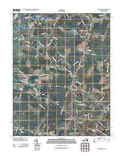
2011 Map of Hallwood
USGS Topo · Published 2011About this map
Temperanceville and Hallwood anchor this detailed study of Virginia's Eastern Shore, where a network of small agricultural and residential centers is linked by the Lankford Hwy. The landscape is defined by the winding tributaries of the Pocomoke River, including Pitts Creek and Bullbegger Creek, which carve through the flat coastal plain. Rural life is evidenced by numerous local post offices such as New Church Post Office and Withams Post Office, alongside the aviation history represented by Sawyer Stolport, High Hopes Airport, and Taylor Airport.
Find a feature on this map
82 named features on this map. Tap any name to fly to it.
Don’t see what you’re looking for? This feature index may not catch every label — zoom into the map to look around manually.
Map Details
Editions of this 2011 Hallwood Map
This is the sole edition of this map. No revisions or reprints were ever made.
Other maps of this area

1901 · Snow Hill
USGS Topo · 1:62,500

1942 · Kingston
USGS Topo · 1:24,000

1942 · Mappsville
USGS Topo · 1:24,000

1942 · Wallops Island
USGS Topo · 1:24,000

1942 · Saxis
USGS Topo · 1:24,000

1942 · Parksley
USGS Topo · 1:24,000

1943 · Parksley
USGS Topo · 1:31,680

1943 · Saxis
USGS Topo · 1:31,680

1943 · Mappsville
USGS Topo · 1:31,680

1943 · Chincoteague West
USGS Topo · 1:31,680