
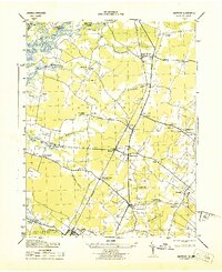
1943 Map of Mappsville
USGS Topo · Published 1943About this map
Coastal hamlets and agricultural lands of the Eastern Shore are documented here during the early 1940s, a period when the Pennsylvania Railroad served as a primary artery through towns like Bloxom and Mears Station. The landscape is a complex network of creeks and necks, where Gargathy Neck and Metomkin Neck extend toward the Atlantic Ocean and the sheltered waters of Kegotank Bay. Small-scale industry and community life are evident through numerous scattered settlements such as Mappsville, Modest Town, and Groton Town, many of which grew around rural institutions like the Mappsville School or the Bethel Church. The mapping detail captures important family and local landmarks, including the Mears Cem and Bloxom Cem, as well as distinctive coastal navigation points like the Northam House South Chimney and the Gargathy Inlet.
Find a feature on this map
75 named features on this map. Tap any name to fly to it.
Don’t see what you’re looking for? This feature index may not catch every label — zoom into the map to look around manually.
Map Details
Editions of this 1943 Mappsville Map
This is the sole edition of this map. No revisions or reprints were ever made.
Other maps of this area

1931 · Accomac
USGS Topo · 1:48,000

1935 · Accomac
USGS Topo · 1:62,500

1942 · Mappsville
USGS Topo · 1:24,000

1942 · Wallops Island
USGS Topo · 1:24,000

1942 · Saxis
USGS Topo · 1:24,000

1942 · Parksley
USGS Topo · 1:24,000

1943 · Parksley
USGS Topo · 1:31,680

1943 · Saxis
USGS Topo · 1:31,680

1943 · Chincoteague West
USGS Topo · 1:31,680
1943 · Hallwood
USGS Topo · 1:31,680