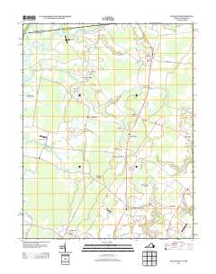
2013 Map of Hallwood
USGS Topo · Published 2013About this map
New Church and Temperanceville anchor the landscape of northern Accomack County in this early 21st-century survey, where the terrestrial terrain of Virginia meets the winding waterways of the Pocomoke drainage. The area is defined by a dense network of small settlements and family-named landmarks, such as Makemie Park, Johnson Corner, and Nash Corner, reflecting a long-standing pattern of dispersed rural communities. Water plays a central role in the geography, with branches like Tunnels Mill Br and N Br Holdens Cr carving through the coastal plain.
Find a feature on this map
91 named features on this map. Tap any name to fly to it.
Don’t see what you’re looking for? This feature index may not catch every label — zoom into the map to look around manually.
Map Details
Editions of this 2013 Hallwood Map
This is the sole edition of this map. No revisions or reprints were ever made.
Other maps of this area

1901 · Snow Hill
USGS Topo · 1:62,500

1942 · Kingston
USGS Topo · 1:24,000

1942 · Mappsville
USGS Topo · 1:24,000

1942 · Wallops Island
USGS Topo · 1:24,000

1942 · Saxis
USGS Topo · 1:24,000

1942 · Parksley
USGS Topo · 1:24,000

1943 · Parksley
USGS Topo · 1:31,680

1943 · Saxis
USGS Topo · 1:31,680

1943 · Mappsville
USGS Topo · 1:31,680

1943 · Chincoteague West
USGS Topo · 1:31,680