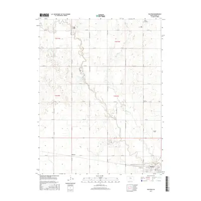
2015 Map of Halstead
USGS Topo · Published 2015About this map
The Little Arkansas River meanders through this portion of Harvey County, shaping the agricultural landscape around the city of Halstead. This modern survey reveals a highly organized township grid defined by section-line roads like Co Rd 801 and N Old Settlers Rd, illustrating the persistence of the Public Land Survey System in Kansas. While Halstead serves as the primary municipal center, smaller legacy points such as Alta Mills and Paxton provide important context for the area's rural development. Historical sites are preserved in the landscape at Fairview Pioneer Cem and the Garden Community Church Cem, offering valuable points for genealogical research. Local aviation is represented by Halstead Airport, while the hydrology is dominated by the river and its tributaries, including Black Kettle Cr and N Br Kisiwa Cr.
Find a feature on this map
53 named features on this map. Tap any name to fly to it.
Don’t see what you’re looking for? This feature index may not catch every label — zoom into the map to look around manually.
Map Details
Editions of this 2015 Halstead Map
This is the sole edition of this map. No revisions or reprints were ever made.
Other maps of this area

1889 · Newton
USGS Topo · 1:125,000

1889 · Cheney
USGS Topo · 1:125,000

1889 · Wichita
USGS Topo · 1:125,000

1891 · Hutchinson
USGS Topo · 1:125,000

1891 · Cheney
USGS Topo · 1:125,000

1893 · Hutchinson
USGS Topo · 1:125,000

1894 · Wichita
USGS Topo · 1:125,000

1894 · Newton
USGS Topo · 1:125,000

1901 · Cheney
USGS Topo · 1:125,000

1955 · Wichita
USGS Topo · 1:250,000