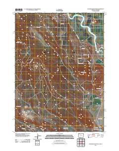
2011 Map of Hamaker Mountain
USGS Topo · Published 2011About this map
The Klamath River winds through this Klamath County landscape, defining the character of the settlement at Keno and creating prominent features like Horsehead Island and Gorr Island. The terrain is marked by significant elevations, notably Hamaker Mountain and Chase Mountain in the west, while Pearson Butte overlooks the southeastern lowlands. This survey illustrates a network of mountain roads such as Chase Mountain Rd and Keno Worden Rd that connect isolated landmarks. Genealogy researchers will find the Keno Cemetery and Worden Cemetery clearly marked, along with small river-adjacent locales like Teeters Landing. The southern portion of the map transitions into the unique hydrology of Bear Valley and the basin containing Lake Miller, showing the intersection of high-desert buttes and riparian corridors.
Find a feature on this map
30 named features on this map. Tap any name to fly to it.
Don’t see what you’re looking for? This feature index may not catch every label — zoom into the map to look around manually.
Map Details
Editions of this 2011 Hamaker Mountain Map
This is the sole edition of this map. No revisions or reprints were ever made.
Other maps of this area

1886 · Modoc Lava Bed
USGS Topo · 1:250,000

1886 · Shasta
USGS Topo · 1:250,000

1889 · Klamath
USGS Topo · 1:250,000

1891 · Ashland
USGS Topo · 1:250,000

1892 · Modoc Lava-Bed
USGS Topo · 1:250,000

1893 · Ashland
USGS Topo · 1:250,000

1894 · Klamath
USGS Topo · 1:250,000

1894 · Shasta
USGS Topo · 1:250,000

1897 · Ashland
USGS Topo · 1:250,000

1934 · Macdoel
USGS Topo · 1:96,000