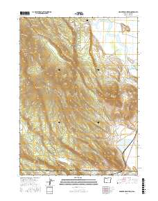
2017 Map of Hamaker Mountain
USGS Topo · Published 2017About this map
Keno sits along a winding stretch of the Klamath River in this survey of the high-elevation terrain straddling the Oregon and California border. The landscape is defined by volcanic prominences such as Hamaker Mtn, Chase Mtn, and Pearson Butte, which rise sharply above the Bear Valley floor. This 2017 data reflects the complex network of access roads serving the timber and ranching lands of southern Klamath Co, including named routes like the Sec 9-Hamaker Tie and Hidden Valley Rd. For local historians and genealogists, the Keno Cem and the river crossing at Tuckers Xing provide specific geographic anchors. In the southeastern corner, the map captures the transition into Siskiyou County, California, showing the marshy expanse of Lake Miller and the distinct volcanic profile of Grenada Butte.
Find a feature on this map
48 named features on this map. Tap any name to fly to it.
Don’t see what you’re looking for? This feature index may not catch every label — zoom into the map to look around manually.
Map Details
Editions of this 2017 Hamaker Mountain Map
This is the sole edition of this map. No revisions or reprints were ever made.
Other maps of this area

1886 · Modoc Lava Bed
USGS Topo · 1:250,000

1886 · Shasta
USGS Topo · 1:250,000

1889 · Klamath
USGS Topo · 1:250,000

1891 · Ashland
USGS Topo · 1:250,000

1892 · Modoc Lava-Bed
USGS Topo · 1:250,000

1893 · Ashland
USGS Topo · 1:250,000

1894 · Klamath
USGS Topo · 1:250,000

1894 · Shasta
USGS Topo · 1:250,000

1897 · Ashland
USGS Topo · 1:250,000

1934 · Macdoel
USGS Topo · 1:96,000