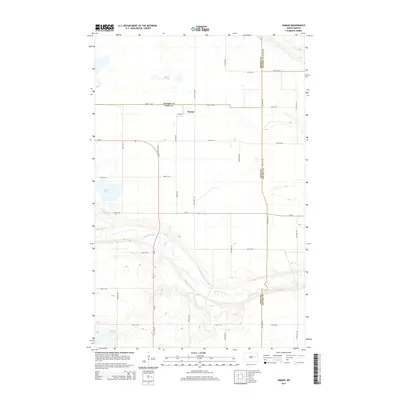
2014 Map of Hamar
USGS Topo · Published 2014About this map
The tiny settlement of Hamar sits at the heart of this prairie landscape, where the borders of Benson, Nelson, and Eddy counties converge. The local topography is defined by the winding course of the Sheyenne River, which snakes across the southern portion of the quadrangle, flanked by distinctive glacial features including Battle Lake, Bakstad Lake, and the marshy expanse of Black Slough.
Find a feature on this map
28 named features on this map. Tap any name to fly to it.
Don’t see what you’re looking for? This feature index may not catch every label — zoom into the map to look around manually.
Map Details
Editions of this 2014 Hamar Map
This is the sole edition of this map. No revisions or reprints were ever made.
Other maps of this area

1930 · Pekin
USGS Topo · 1:62,500

1930 · Hamar
USGS Topo · 1:62,500

1950 · Devils Lake Mountain
USGS Topo · 1:24,000

1951 · Devils Lake Mountain
USGS Topo · 1:24,000

1951 · Pekin NW
USGS Topo · 1:24,000

1951 · Free Peoples Lake
USGS Topo · 1:24,000

1951 · Tolna
USGS Topo · 1:24,000

1951 · Pekin
USGS Topo · 1:62,500

1952 · New Rockford
USGS Topo · 1:250,000

1956 · New Rockford
USGS Topo · 1:250,000