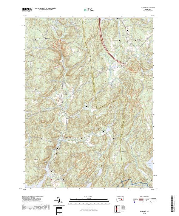
2024 Map of Hamburg
USGS Topo · Published 2024About this map
Hamburg and its surrounding countryside in New London County are defined by the winding course of the Eightmile Wild and Scenic River, which flows south toward Hamburg Cove. The landscape is a mosaic of small settlements like North Lyme and Millington, interspersed with high ridges such as Chapman Ridge and Whittlesey Ridge. This modern survey details a region deeply rooted in early Connecticut history, as evidenced by the high concentration of family and community burial grounds including Millington Cem, Foxtown Cem, and the Sterling Family Cem. Notable landmarks include the dramatic Chapman Falls and Devils Hopyard Field in the north, while the southern reaches contain the NG Stones Ranch Military Res. This map provides an exceptionally clear view of how contemporary road networks, such as Norwich Salem Rd and Haywardville Rd, navigate the varied terrain of hills like Mt Archer and Tater Hill.
Find a feature on this map
132 named features on this map. Tap any name to fly to it.
Don’t see what you’re looking for? This feature index may not catch every label — zoom into the map to look around manually.
Map Details
Editions of this 2024 Hamburg Map
This is the sole edition of this map. No revisions or reprints were ever made.
Other maps of this area

1892 · New London
USGS Topo · 1:62,500

1892 · Norwich
USGS Topo · 1:62,500

1892 · Gilead
USGS Topo · 1:62,500

1893 · New London
USGS Topo · 1:62,500

1893 · Saybrook
USGS Topo · 1:62,500

1921 · New London
USGS Topo · 1:62,500

1934 · Niantic
USGS Topo · 1:24,000

1935 · Montville
USGS Topo · 1:24,000

1938 · Niantic
USGS Topo · 1:62,500

1939 · Montville
USGS Topo · 1:31,680