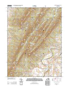
2013 Map of Hamburg
USGS Topo · Published 2013About this map
The S Fork Shenandoah River carves through the landscape of Page County, shaping the placement of long-standing riverfront communities. At Whitehouse Landing, the water meets the established settlement of White House, while further downstream, Hamburg and Leaksville anchor the agricultural and residential corridors. The terrain is dominated by the massive presence of Massanutten Mountain, which creates a natural barrier punctuated only by high points like Strickler Knob and Duncan Knob. This survey captures a mix of forest-dwelling neighborhoods and valley floor crossroads. In the north, Little Fort Valley sits tucked away near Passage Creek, while the development of Shenandoah Forest illustrates the modern residential expansion into the timbered slopes. The map also records several notable water sources, including Big Spring and Hiden Spring, which have historically dictated local settlement patterns in this part of the Virginia valley.
Find a feature on this map
99 named features on this map. Tap any name to fly to it.
Don’t see what you’re looking for? This feature index may not catch every label — zoom into the map to look around manually.
Map Details
Editions of this 2013 Hamburg Map
This is the sole edition of this map. No revisions or reprints were ever made.
Other maps of this area

1892 · Woodstock
USGS Topo · 1:125,000

1893 · Luray
USGS Topo · 1:125,000

1905 · Luray
USGS Topo · 1:125,000

1923 · Edinburg
USGS Topo · 1:62,500

1929 · Stony Man
USGS Topo · 1:48,000

1933 · Stony Man
USGS Topo · 1:62,500

1942 · Mt Jackson
USGS Topo · 1:62,500

1946 · Mt Jackson
USGS Topo · 1:62,500

1947 · Mt Jackson
USGS Topo · 1:62,500

1947 · Strasburg
USGS Topo · 1:62,500