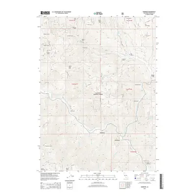
2015 Map of Hamburg
USGS Topo · Published 2015About this map
The Klamath River carves a deep, winding path through this portion of the Klamath National Forest, where the settlement of Hamburg sits at the confluence of Hamburg Gulch. This 2015 survey shows a landscape defined by sharp elevation changes, from the heights of the Marble Mountains and White Cloud Mtn down to the river valley. The confluence of the Scott River near Steelhead marks a major hydrological junction in the southeastern quadrant. Numerous drainages, often named for local figures or wildlife such as Johnny O'Neil Ridge, Sambo Gulch, and Williams Gulch, reveal the complex topography of the Siskiyou mountains. Genealogists may find interest in the Horse Creek Cemetery, located north of the Horse Creek community, while landmarks like Telephone Saddle and Browns Knob provide specific points of reference within the dense forest terrain.
Find a feature on this map
48 named features on this map. Tap any name to fly to it.
Don’t see what you’re looking for? This feature index may not catch every label — zoom into the map to look around manually.
Map Details
Editions of this 2015 Hamburg Map
This is the sole edition of this map. No revisions or reprints were ever made.
Other maps of this area

1886 · Shasta
USGS Topo · 1:250,000

1894 · Shasta
USGS Topo · 1:250,000

1914 · Seiad
USGS Topo · 1:125,000

1922 · Seiad
USGS Topo · 1:125,000

1932 · Yreka
USGS Topo · 1:96,000

1939 · Yreka
USGS Topo · 1:125,000

1948 · Weed
USGS Topo · 1:250,000

1950 · Weed
USGS Topo · 1:250,000

1955 · Seiad Valley
USGS Topo · 1:62,500

1955 · Condrey Mtn
USGS Topo · 1:62,500