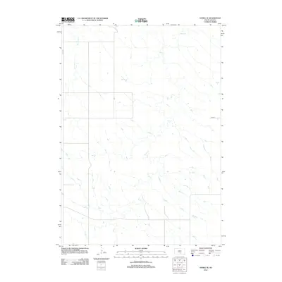
2012 Map of Hamill SE
USGS Topo · Published 2012About this map
Bull Creek dominates the hydrology of this South Dakota landscape, its winding course and associated tributaries carving a complex network of drainage across the prairie. The western portion of the quadrangle is defined by the straighter path of Black Dog Creek, which flows northward through an area marked by a sparse, grid-based road network typical of the Great Plains. A section of 264th St provides the primary east-west corridor in the southern reaches of the map. This 2012 survey illustrates the enduring rural character of the region, where the terrain is largely shaped by natural watercourses rather than dense human settlement, preserving the original land divisions and seasonal stream beds of the northern plains.
Find a feature on this map
3 named features on this map. Tap any name to fly to it.
Don’t see what you’re looking for? This feature index may not catch every label — zoom into the map to look around manually.
Map Details
Editions of this 2012 Hamill SE Map
This is the sole edition of this map. No revisions or reprints were ever made.
Other maps of this area

1940 · Iona
USGS Topo · 1:62,500

1944 · Iona
USGS Topo · 1:62,500

1952 · Hamill NW
USGS Topo · 1:24,000

1952 · Hamill NE
USGS Topo · 1:24,000

1952 · Iona NW
USGS Topo · 1:24,000

1955 · Mitchell
USGS Topo · 1:250,000

1959 · Mitchell
USGS Topo · 1:250,000

1971 · Hamill SE
USGS Topo · 1:24,000

1971 · Rattlesnake Butte East
USGS Topo · 1:24,000

1971 · Hamill
USGS Topo · 1:24,000