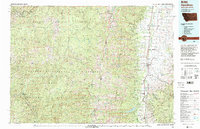
1980 Map of Hamilton
USGS Topo · Published 1997About this map
Hamilton and the fertile valley of the Bitterroot River serve as the focal point of this 1980 survey, where human settlement meets the towering Bitterroot Range. The Bitterroot Valley is punctuated by a string of towns including Victor, Corvallis, and Darby, connected by a network of roads that follow the river's path. To the west, the landscape transforms into the sprawling Selway-Bitterroot Wilderness, part of the Clearwater, Nezperce, and Bitterroot national forests. This region is defined by sharp peaks like St. Mary Peak and El Capitan, and drained by numerous tributaries such as Blodgett Creek and Roaring Lion Creek. The map documents the protected waters of the Lochsa Wild and Scenic River and the Middle Fork Clearwater Wild and Scenic River, illustrating the era's balance between established ranching communities in the valley and the preservation of the vast Idaho-Montana backcountry.
Find a feature on this map
53 named features on this map. Tap any name to fly to it.
Don’t see what you’re looking for? This feature index may not catch every label — zoom into the map to look around manually.
Map Details
Editions of this 1980 Hamilton Map
2 editions found
Other maps of this area

1901 · Hamilton
USGS Topo · 1:125,000

1903 · Bonner
USGS Topo · 1:125,000

1909 · Sapphire
USGS Topo · 1:125,000

1911 · Lolo
USGS Topo · 1:250,000

1912 · Missoula
USGS Topo · 1:125,000

1913 · Lolo
USGS Topo · 1:250,000

1947 · Butte
USGS Topo · 1:250,000

1955 · Dillon
USGS Topo · 1:250,000

1956 · Elk City
USGS Topo · 1:250,000

1956 · Hamilton
USGS Topo · 1:250,000